Orbital Insight
August 19th, 2015
Via Red Bulletin, an interesting look at Orbital Insight, a geospatial Big Data company leveraging the rapidly growing availability of satellite, UAV, and other geospatial data sources, to understand and characterize socio-economic trends at global, regional, and hyper-local scales:

La forêt de Mariba, Ouganda : le 27 novembre 2001 (à gauche), le 25 janvier 2006 (à droite).
What?
Technology that monitors deforestation.
Why?
To protect the world’s forests.
When?
Now. California startup Orbital Insight has partnered with Global Forest Watch to create a system that monitors and flags suspicious changes around forested areas, such as unexpected new roads. As the system’s neural network recognizes more and increasingly detailed patterns, it will become more accurate at detecting changes and helping to prevent illegal deforestation.
,
Read More »Google Powers Online Resource Tracking Global Deforestation
August 21st, 2014
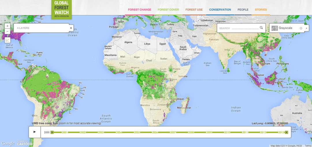
Via Forbes, a report on a new tool that – using technologies from Google Maps and Google Earth, the World Resources Institute has created an interactive map that shows forest coverage almost in real time, marking where coverage has increased and — more often — where it’s decreased:
Last fall, I wrote about efforts by Google and Microsoft to help put some analytics muscle behind tracking various natural resources.
Now, Google has teamed up with the World Resources Institute (WRI) and more than 40 other organizations to create a massive, near real-time forest monitoring system, called Global Forest Watch.
The master plan is to provide a crowdsourced resource that businesses, communities and local governments can use to keep abreast of deforestation, mining and other activities that could threaten tree cover and biodiversity. It relies on Google’s cloud services and mapping resources from Esri, satellite technology, open data tools and feeds from numerous scientific sources, including daily forest fire alerts from NASA. When forest losses are detected, anyone using the resource is alerted. The data for monthly tree loss, for example, is accurate to a resolution of 50 meters; on an annual basis, the accuracy is 30 meters.
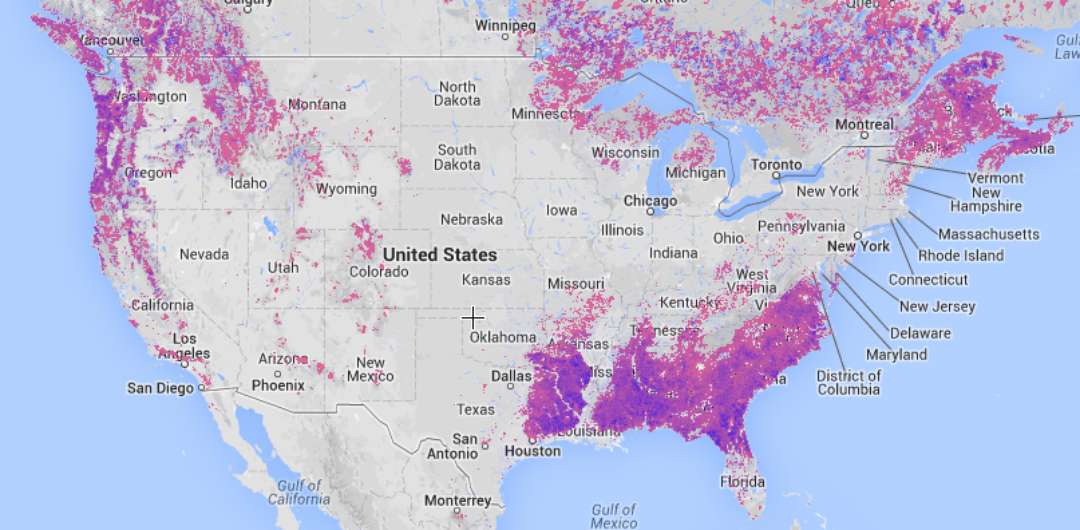
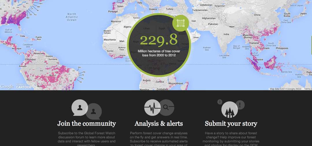
Screenshots of the Global Forest Watch Web App.
“Businesses, governments and communities desperately want better information about forests. Now they have it. … From now on, the bad guys cannot hide and the good guys will be recognized for their stewardship,” said Andrew Steer, president and CEO of WRI.
Between 2000 and 2012, the world lost 2.3 million square kilometers (or 230 million hectacres), which is the same as cutting down 50 soccer fields worth of trees every day. The most threatened regions during that timeframe were Brazil, Canada, Indonesia, Russia and the United States. (I am listing them alphabetically, not necessarily in their order of contribution to the decline.)
How would a business use this resource?
Paper companies, for example, could keep watch over timber suppliers to ensure that their concessions aren’t encroaching on rainforests. Asia Pulp & Paper intrigued many almost exactly one year ago when it embraced a far-reaching conservation strategy. Organizations that rely on palm oil, soy or beef for their products might likewise monitor how their supply chain partners are complying with local regulations for sourcing or cultivating these commodities or with sustainable resource commitments. Among two big players that are already using this tool are Nestle and Unilever.
“Deforestation poses a material risk to businesses that rely on forest-linked crops. Exposure to the risk has the potential to undermine the future of businesses,” said Unilever CEO Paul Polman. That’s one reason that the company has pledged to source all of its agricultural raw materials “sustainably.:
Here’s the thing, if your team needs to start tracking this sort of thing, why not use an open source like this one? WRI is also behind a similar resource for mapping water risks, called Aqueduct.
,
Read More »


